 |
|
 |
 |
 |
 |
 |
 |
|
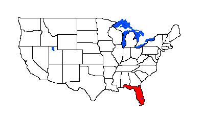
Thonotosassa Associated Dates: 7000 – 5000 Y.B.P.
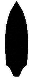
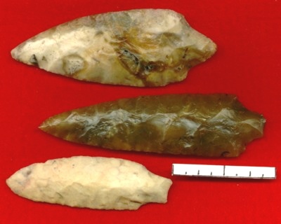
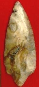
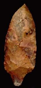
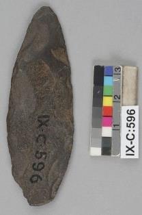
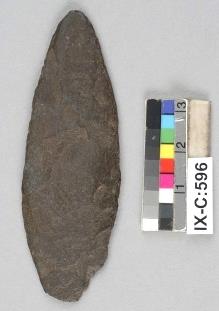
General Description: "…Bullen describes them with four subtypes (Kendal Books, 1975). [It is] a very long and rather heavy, percussion-chipped point with various basal modifications and minimum edge retouch. Subtype 3 usually exhibits basal notching. Extreme length is a trait of this point. [It is] named for Thonotosassa, Florida, a community next to a large lake with same name; most common in Hillsborough, Pasco, Polk, Pinellas, Hernando and Citrus Counties .Made of heat-altered local cherts and corals, this type is known to be large and long in its first stage, with several variables in stem shapes. Most examples found have been used for knives and have seen many resharpenings resulting in short blades. Edge retouch and resharpening process [are the] same as for the Florida Cypress Creek. Careful: Exhausted Thonotosassa points are often confused with the Putnam type. See Florida Cypress Creek, Hamilton and Putnam." (TEXT SOURCE: not attributed) THONOTOSASSA POINT THUMBNAIL GALLERY (24 images: 12 source images/12 thumbnails)
End of Thonotosassa Thumbnails - Complete
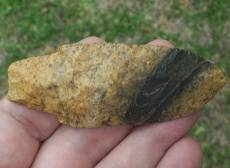
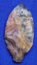
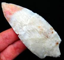
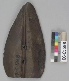
ABOVE: THON01: Thonotosassa point, Hillsborough Co., Florida
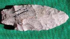
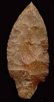
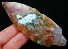
ABOVE: THON02: Thonotosassa point; Tampa, Florida; 3.43 inches (87.1); first of two images
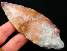
ABOVE: THON03: second view of Thonotosassa point shown above
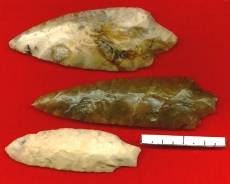
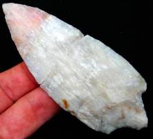
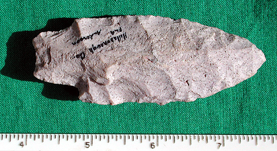
ABOVE: THON04: Thonotosassa points; Hillsborough Co., Florida
ABOVE: THON05, THON06, THON07 AND THON08: Thonotosassa points; Florida; no details
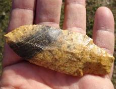
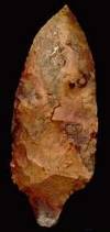
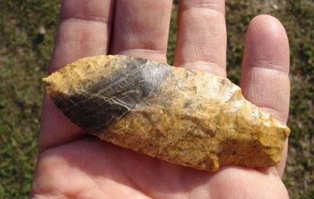
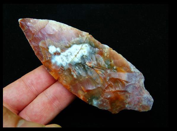
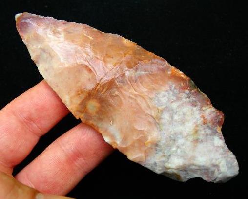
ABOVE: THON09: Thonotosassa point (broken and glued); Hernando Co., Florida; 4.75 inches (120.6mm); heat-treated coral. Source: Riversoftime dot com
ABOVE: THON10: second of two views of Thonotosassa point described above. Source: Riversoftime dot com
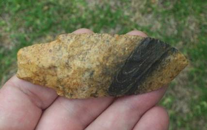
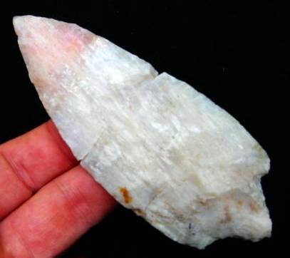
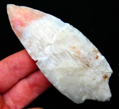
ABOVE: THON11: Thonotosassa point (broken and glued); Hernando Co., Florida; 4.38 inches (111.2mm); heat-treated coral. Source: Riversoftime dot com
ABOVE: THON12: second of two views of Thonotosassa point described above. Source: Riversoftime dot com End of Thonotosassa - Complete Thule Associated Dates: see below General Description: Recent DNA research would suggest that the Thule have existed in Alaska since at least 3,000 years ago and perhaps 4,000 years ago or more; The Thule began entering Canada from Alaska around the year 1000 and had settled in Greenland by approximately 1300. (Arctic Studies Center Newsletter, National Museum of Natural History, Smithsonian Institution, June, 2002 http://www.mnh.si.edu/arctic/html/pdf/news02.pdf ). .The Thule are the direct ancestors of modern Inuit (term employed in Canada and Greenland) and Inupiat (the Inuit of Alaska). It should be noted that "Inuit” only applies in Alaska to the Inupiat; “Eskimo” is the generic Alaskan term applied to encompass both the Inupiat and the Yupik peoples (linguistically distinct peoples). “Eskimo” is used in Canada and Greenland only as a reference to the non-related predecessors of the Thule/Inuit known collectively as ”Palaeo-Eskimo.” In the images which are found in this section, several attributive terms are employed. “Thule” and “Thule/Historic Inuit” tend to be descriptions from Canadian or Danish/Greenland sources. “Inupiat” (plural) or “Inupiaq” (singular) usually indicates an American source. INUIT GROUPS
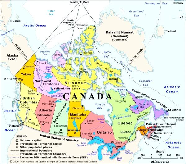
ABOVE: THULE01a: principal distribution areas of the Inuit discussed in the preface (for an overview of Inuit-inhabited areas, see the following map). Source: Natural Resources Canada
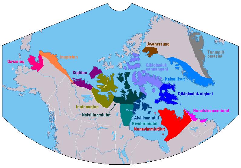
ABOVE: THULE01b: dialect distribution map shows modern Inuit distribution; for political correlations, refer to map 01a preceding. Source: Wikipedia THULE THUMBNAIL GALLERY (208 images: 104 source images/104 thumbnails)
End of Thule Thumbnails - 8 out of 104 Complete
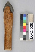
ABOVE: THULE01 AND THULE02: Thule/Historic Inuit arrowhead; Northwest Territories, Canada; 2.4 inches (61mm). Source: Canadian Museum of Civilization http://collections.civilisations.ca
ABOVE: THULE03 AND THULE04: Thule/Historic Inuit knife blade; Northwest Territories, Canada; 2.87 inches (73mm). Source: Canadian Museum of Civilization http://collections.civilisations.ca
ABOVE: THULE05 AND THULE06: Thule/Historic Inuit end blade; Northwest Territories, Canada; 1.61 inches (41mm). Source: Canadian Museum of Civilization http://collections.civilisations.ca |
|
©2010 J Keffer |